
Babusar Top
Kaghan Valley, Mansehra District, Khyber Pakhtunkhwa
On video
Babusar Top to Chilas — Driving over Babusar Pass by Farhan Rafiq on YouTube. Not ours, and not an endorsement — it is the clearest look at the drive and the valley we could find.
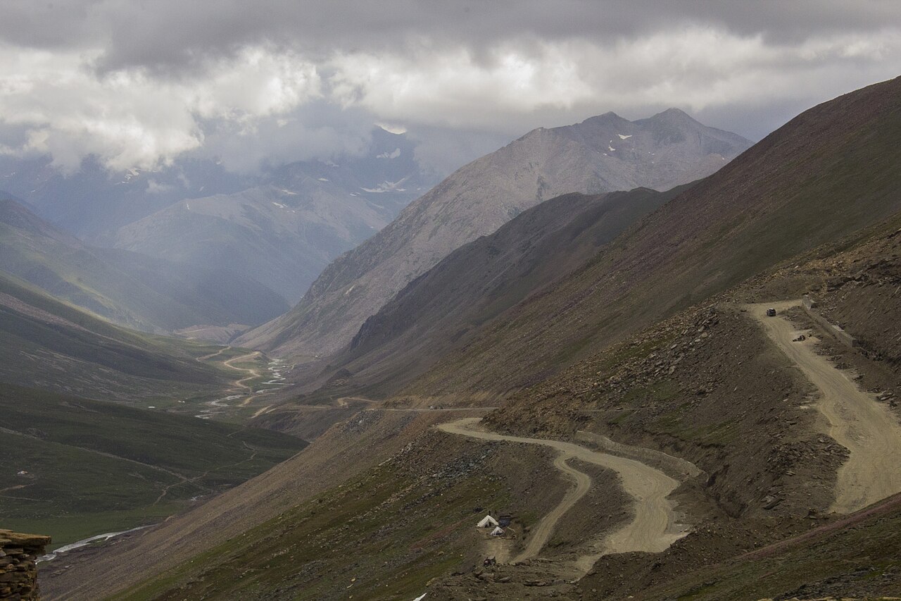
Babusar Top is the pass at 4,173 metres where the Kaghan valley ends and Gilgit-Baltistan begins. It is the highest road in Pakistan most people will ever drive, it is open for about ten weeks a year, and the descent to Chilas is where the accidents happen.
Before you set off: This is the highest point in the Kaghan valley an ordinary car can reach, and it is also one of the most dangerous roads in Pakistan. People are killed here every year, and the usual cause is brake failure on the descent in the hands of a driver who has not done a drop like this before. Use a low gear going down and do not ride the brakes. The road north of Naran is normally open from mid-July to the end of September and shut by snow the rest of the year.
Weather at Babusar Top
Up at 4,178 m: -4.4°C there now, clear. Over the next 24 hours -20.3°C to -1.7°C. It goes below freezing.
This is the weather at Babusar Top, not a road report — whether the road is open depends on ploughing, landslides and local decisions no forecast knows about, so check before you set off. Forecast from MET Norway, CC BY 4.0.
What it costs to drive there
| From | Distance | Driving | Petrol |
|---|---|---|---|
| Islamabad | 311 km | 3.8 h | Rs 8,400 |
| Rawalpindi | 315 km | 3.9 h | Rs 8,500 |
| Lahore | 666 km | 7.6 h | Rs 18,000 |
| Karachi | 1716 km | 19.9 h | Rs 46,500 |
| Peshawar | 401 km | 4.6 h | Rs 10,900 |
| Multan | 812 km | 10.4 h | Rs 22,000 |
A car doing 12 km/l at today’s Rs 325.00/litre. Open a row to work it out for your own car, your own speed and with the air conditioning on — or see every distance from Babusar Top.
What it is
A mountain pass at 4,173 metres at the northern end of the Kaghan valley in Mansehra District, connecting Khyber Pakhtunkhwa with Gilgit-Baltistan and joining the Karakoram Highway at Chilas in Diamer District.
It is the highest point in the Kaghan valley that can be reached easily by car, which is the whole appeal — and the reason so many cars that should not be up there are.
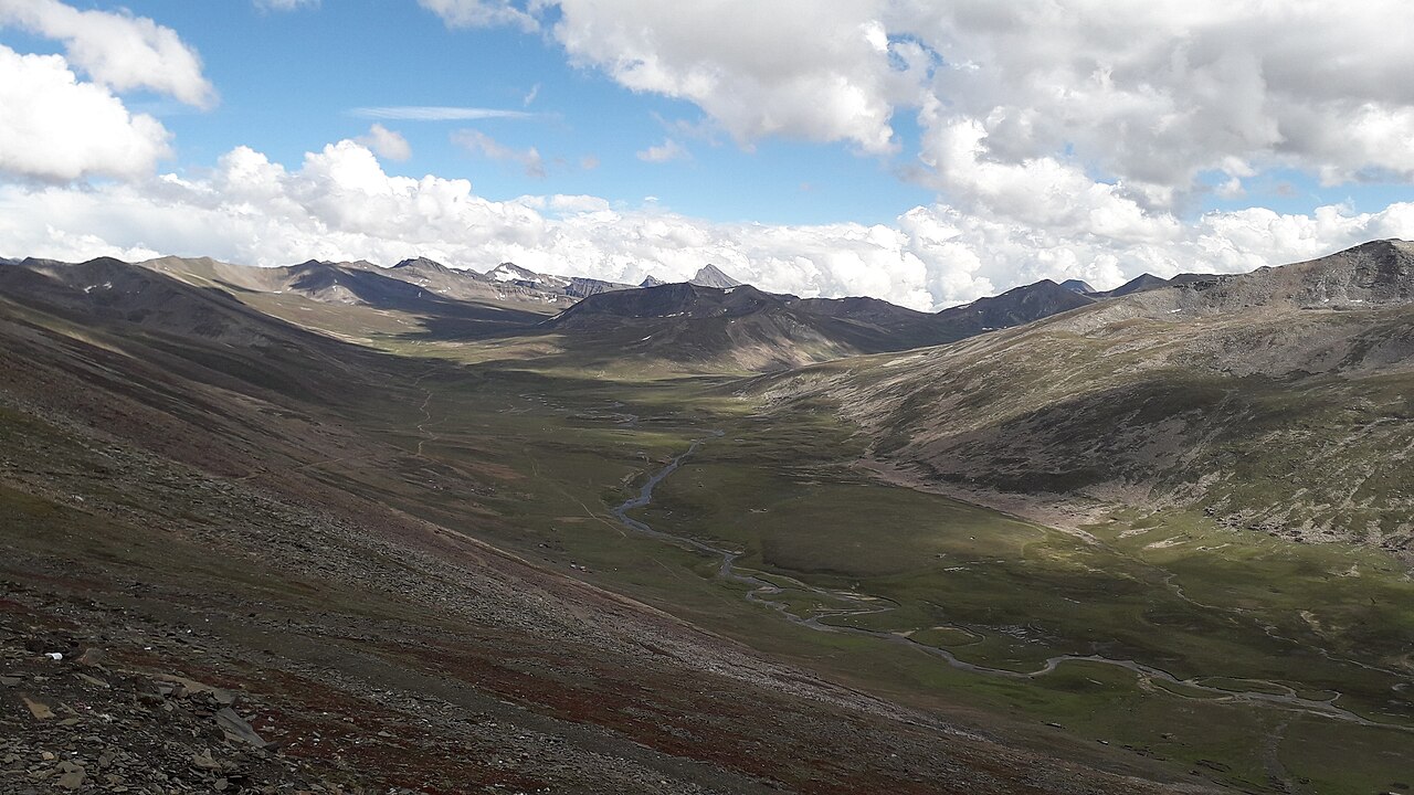
Why it is dangerous
Casualties are reported from this road every year. The most common cause given is brake failure on the steep descent, driven by inexperience rather than by a fault in the car: continuous braking down a drop this long overheats the system until there is nothing left.
The fix is the one every mountain driver knows and most holiday drivers do not: pick a low gear and let the engine hold the car, instead of sitting on the pedal. Check the brakes before the climb, not at the top.
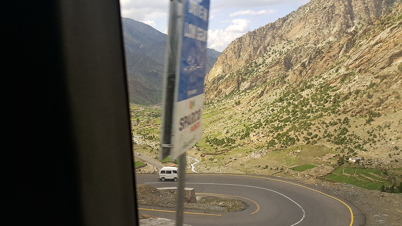
The season
Summer in the Kaghan valley runs from May to September, with about 11°C at the top end of May and 3°C at the bottom. From mid-July to the end of September the road north of Naran is normally open the whole way to the pass.
Outside that, movement is limited by the monsoon and then shut by winter snow. When Babusar is closed, traffic for the north uses the Karakoram Highway instead — longer, lower, open.
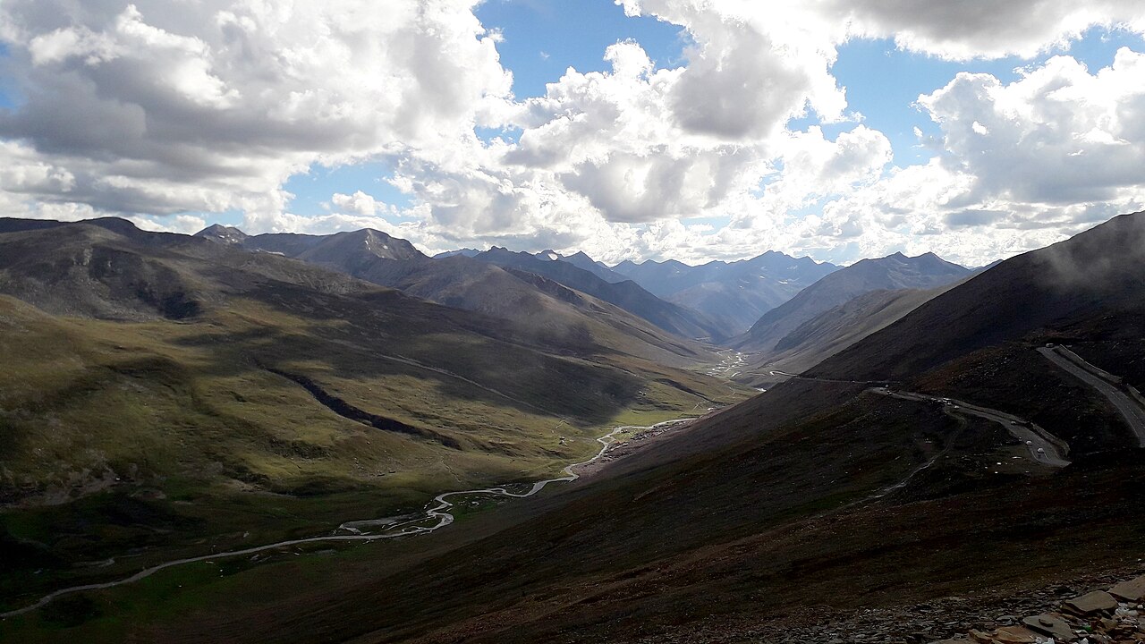
What is around it
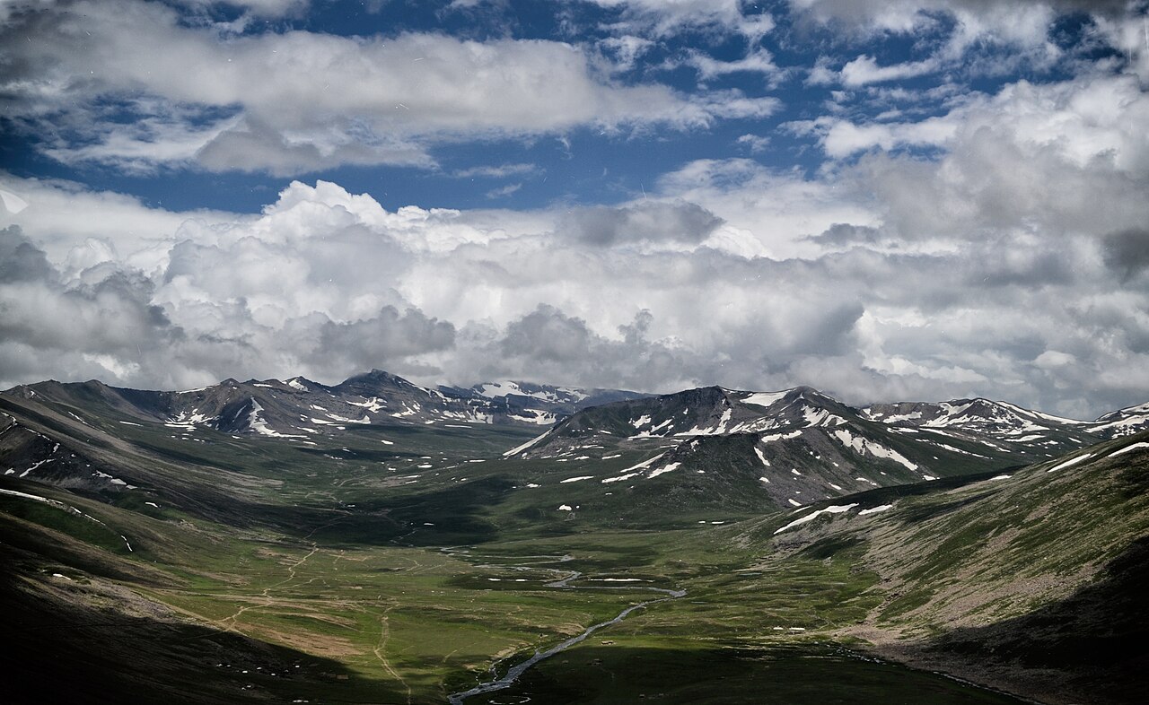
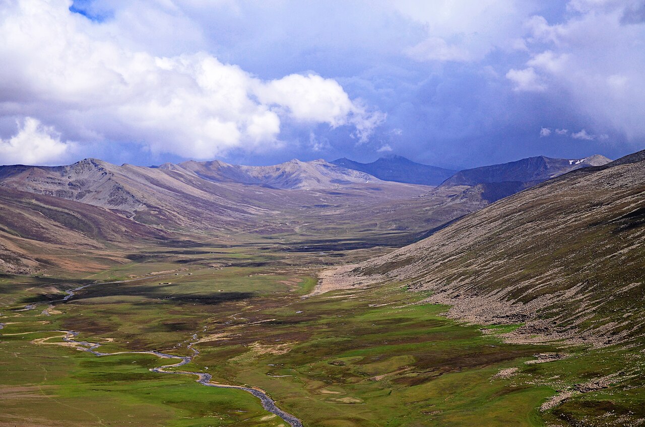
The mountains here are the western end of the Himalaya. Malika Parbat, over 5,200 metres and the highest peak in the valley, flanks the right bank of the Kunhar river below.
Nomadic herders bring sheep and goats up to these grasslands for the summer grazing, which is most of what moves on the pass when the traffic thins.
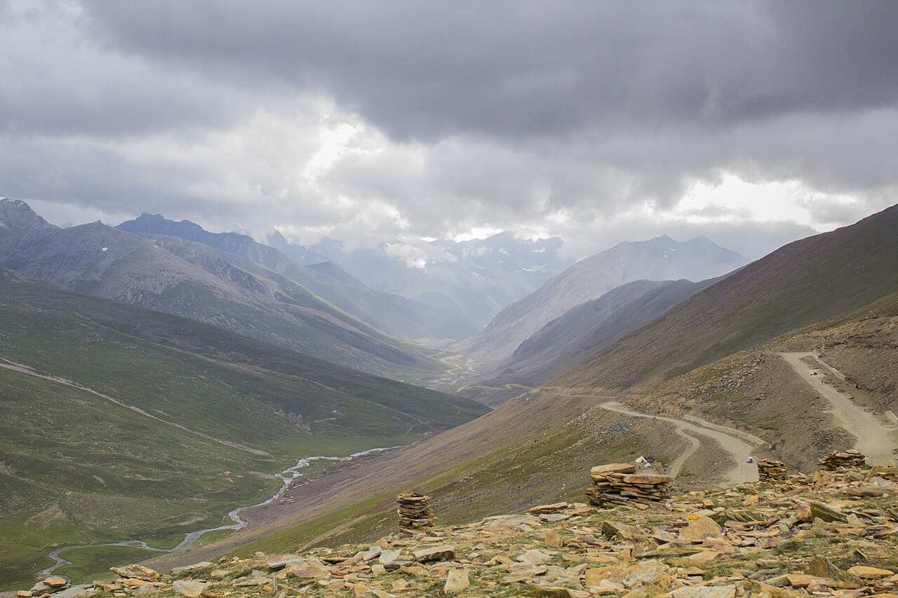
What there is to see
- The top
- 4,173 metres, a car park, a few stalls and a view in both directions.
- The Chilas descent
- The switchbacks down to the Indus. Spectacular, and the part to take slowly.
- Gittidas
- The meadow below the pass on the Kaghan side.
- Lulusar
- The lake on the valley road, passed on the way up from Naran.
- Chilas
- On the Karakoram Highway at the bottom, and the way on to Gilgit and Hunza.
When to go, and when not to
Mid-July to the end of September, when the road north of Naran is normally open all the way. May and June are a gamble on how the snow has gone.
In winter the pass closes under heavy snow and harsh conditions. Treat an early or late crossing as something to confirm locally on the day rather than to plan around.
Where this comes from
- Babusar Pass — Wikipedia — The 4,173-metre height, the connection to Chilas and the Karakoram Highway, the description as the highest point in Kaghan reachable by car, the annual casualties and brake failure, the mid-July to September season and the temperature figures, and the geography. Written from it, not copied; Wikipedia is CC BY-SA 4.0.
- MET Norway — The live forecast and the pass's height, CC BY 4.0.
- OpenStreetMap — Road distances and driving times, via OSRM.