
Ganga Choti
Bagh District, Azad Kashmir
On video
Above the Clouds: Discovering Beautiful Ganga Choti In AJK — EP1 by Travel With Nabeel on YouTube. Not ours, and not an endorsement — it is the clearest look at the drive and the valley we could find.
Ganga Choti is a 3,045-metre ridge in the Pir Panjal above Bagh, and the rarest kind of high place in Pakistan: one you can reach on a day out from Islamabad without a trek, a permit or a 4×4. The walk up from Sudhan Gali is eight kilometres of open grass.
How far you can drive: The distances below are to Bagh, the district town. Sudhan Gali is about twenty kilometres further on a metalled road, and from there the summit is an eight-kilometre walk uphill — an off-road vehicle shortens it but nothing drives to the top. The forecast on this page is for Bagh at 1,092 metres, not for a ridge at 3,045 metres, which will be a great deal colder.
Weather at Bagh
Up at 1,092 m: 20.7°C there now, clear. Over the next 24 hours 9°C to 24.1°C.
This is the weather at Bagh, not a road report — whether the road is open depends on ploughing, landslides and local decisions no forecast knows about, so check before you set off. Forecast from MET Norway, CC BY 4.0.
What it costs to drive to Bagh
| From | Distance | Driving | Petrol |
|---|---|---|---|
| Islamabad | 151 km | 1.8 h | Rs 4,100 |
| Rawalpindi | 160 km | 2 h | Rs 4,300 |
| Lahore | 386 km | 5.1 h | Rs 10,500 |
| Karachi | 1567 km | 18.3 h | Rs 42,400 |
| Peshawar | 329 km | 3.8 h | Rs 8,900 |
| Multan | 687 km | 8.3 h | Rs 18,600 |
A car doing 12 km/l at today’s Rs 325.00/litre. Open a row to work it out for your own car, your own speed and with the air conditioning on — or see every distance from Bagh.
What it is
A peak at 3,045 metres in Bagh District, part of the Pir Panjal range of the Lower Himalaya. It sits between the union council of Birpani and the town of Sudhan Gali, in the village of Bani Minhasan.
Before Kashmir was partitioned the peak stood on the boundary between the Kashmir and Jammu districts. The name is local, and is said to come from the Hindu families who lived in this country before 1947.

Two ways up
There are two approaches: one from Chikar, and one along the Bagh–Sudhan Gali road. Sudhan Gali is a small town about four kilometres from the peak with a few shops and hotels, which makes it the practical base.
From Sudhan Gali it is an eight-kilometre uphill hike to the summit. Off-road vehicles can shorten the walk, but the top itself is reached on foot.
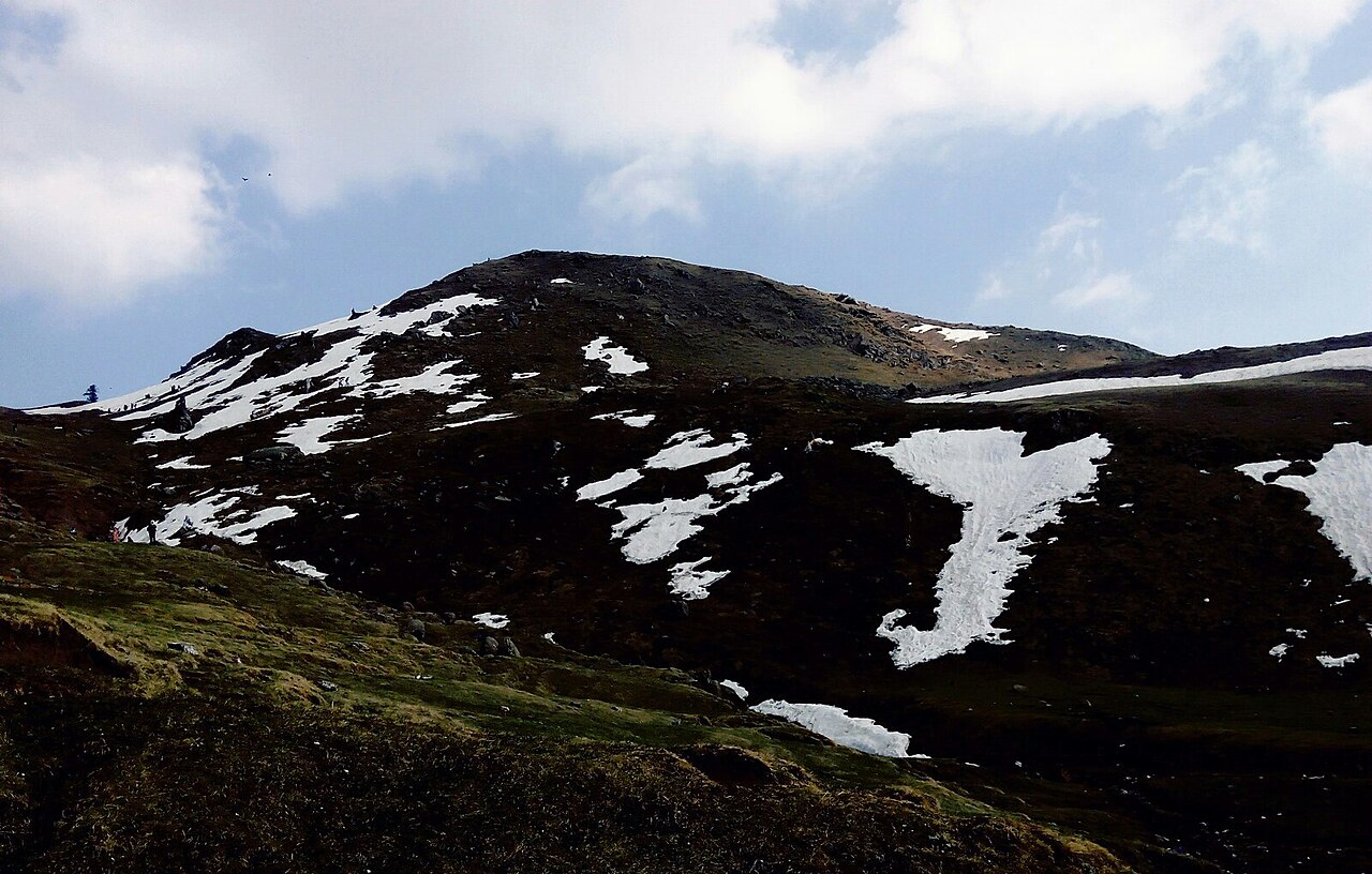
Snow, and what is being made of it
In recent years the AJK Winter Sports Association has been running winter sports on the ridge, deliberately, as a way of bringing tourism and some money into the area outside the summer months.
That is worth knowing in both directions. In winter there is something organised happening up here; it also means the snow that makes it possible is deep enough to matter on the road and on the walk.
What there is to see
- The summit ridge
- 3,045 metres of open grass, with the Pir Panjal in both directions on a clear day.
- Sudhan Gali
- About four kilometres from the peak. Shops, a few hotels, and where the walk starts.
- The Chikar approach
- The other way in, from the Muzaffarabad side rather than through Bagh.
- Bagh
- The district town below, and as far as the distances on this page are measured.
When to go, and when not to
Late spring to early autumn is the straightforward season: the grass is open, the walk is pleasant and the road is clear. The ridge is high enough that it is cold at the top even when Bagh is warm, so a jacket is not optional.
In winter the ridge carries real snow — enough for the winter sports that are held on it. That is a trip to plan for rather than to attempt on a whim, and the approach road is the part that catches people out.
Where this comes from
- Ganga Choti — Wikipedia — The 3,045-metre height, the Pir Panjal, the two approaches, the eight-kilometre walk from Sudhan Gali, the name's origin and the winter sports. Written from it, not copied; Wikipedia is CC BY-SA 4.0.
- MET Norway — The live forecast and the town's height, CC BY 4.0.
- OpenStreetMap — Road distances and driving times, via OSRM. The Bagh–Sudhan Gali figure is from the same source.