
Kund Malir
Hingol National Park, Lasbela District, Balochistan
On video
Balochistan Road Journey on the Coastal Highway — Karachi to Gwadar, Ormara and Kund Malir (4K) by Trillionex Travel on YouTube. Not ours, and not an endorsement — it is the clearest look at the drive and the valley we could find.
Kund Malir is a beach in the middle of Hingol National Park, about 240 kilometres west of Karachi on the Makran Coastal Highway. The drive is the attraction as much as the beach: desert, canyon, mud volcano and then the Arabian Sea, on a road that only opened in 2004.
Before you set off: After Zero Point there are no food or fuel facilities for the rest of the route — fill up before you leave the junction and carry water. The Makran Coastal Highway itself is good tarmac and an ordinary car is fine on it. Access to the coastal stretch has at times been restricted after dark, so start early and check the position locally before you go.
What it costs to drive there
| From | Distance | Driving | Petrol |
|---|---|---|---|
| Islamabad | 1599 km | 19.2 h | Rs 43,300 |
| Rawalpindi | 1596 km | 19.2 h | Rs 43,200 |
| Lahore | 1440 km | 16.5 h | Rs 39,000 |
| Karachi | 239 km | 2.9 h | Rs 6,500 |
| Peshawar | 1541 km | 19.3 h | Rs 41,700 |
| Multan | 1120 km | 13 h | Rs 30,300 |
A car doing 12 km/l at today’s Rs 325.00/litre. Open a row to work it out for your own car, your own speed and with the air conditioning on — or see every distance from Kund Malir.
What it is
A beach in Hingol National Park in Lasbela District, roughly 150 kilometres from Zero Point on the Makran Coastal Highway and about 237 kilometres west of Karachi. It was put on a list of Asia's fifty most beautiful beaches in 2018.
It is a weekend and day-trip destination for Karachi and interior Sindh, and the combination of mountains, ocean and desert within a few hundred metres is the thing people come for. There are an estimated eleven active mud volcanoes around it.

The park it sits in
Hingol is the largest national park in Pakistan: about 6,100 square kilometres across Gwadar, Lasbela and Awaran districts, 200 kilometres north-west of Karachi, declared in 1988. It is named after the Hingol river, which runs through it and forms an estuary before reaching the Arabian Sea.
It holds several distinct ecosystems — arid subtropical forest to the north, barren mountains to the south, the river tributary with thousands of migratory birds and marsh crocodiles, and the sea. That mix of desert and plains makes it unlike any other national park in the country.
There are about 257 plant and 289 animal species recorded, including 35 mammals. Marsh crocodiles are seen regularly on the coastline, with perhaps 60 in the park. Indo-Pacific dolphins and green and olive turtles live in Hingol bay; the turtles come ashore at night in August to lay, and plastic on the beach has cut their numbers badly.

The rocks everyone stops for
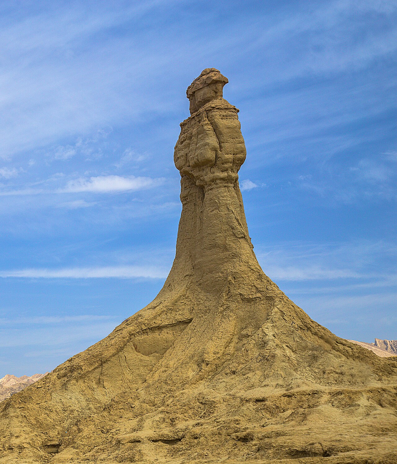
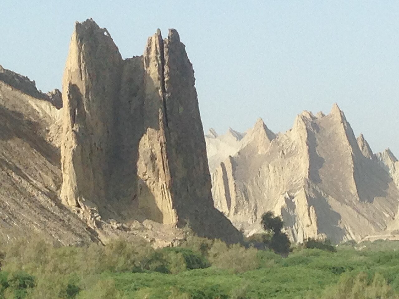
The park's rock formations have been pulling tourists since the Makran Coastal Highway was finished in 2004 — before that almost nobody came. A joint study by the universities of Geneva and Tehran on this coastal strip of Iran and Balochistan identified 36 formations.
The two with names are the Princess of Hope and the Sphinx, both beside the road and both wind-cut. Neither needs a walk; you stop the car and they are there.
Hinglaj
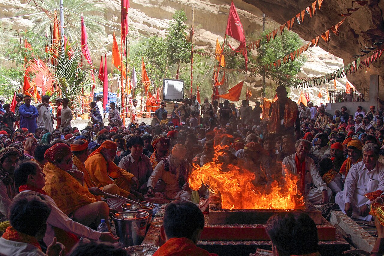
The Hinglaj Mata temple is in the park, one of the most important Hindu pilgrimage sites in Pakistan, with a yatra held each spring.
It is a working shrine rather than a monument, and visitors are worth treating as guests of the people using it.

What there is to see
- The beach
- Sand dunes meeting the sea with mountains behind — the whole reason for the drive.
- Princess of Hope
- The wind-cut rock figure beside the highway.
- The Sphinx
- The other formation, a short way along the same road.
- Hinglaj Mata temple
- In the park, with a spring pilgrimage.
- The mud volcanoes
- About eleven active ones around Kund Malir.


When to go, and when not to
November to February. This is coastal Balochistan: the winter half of the year is pleasant and the summer half is brutal, and there is no shade anywhere on the route.
Go there and back in daylight. The restriction some travellers have met on entering the coastal stretch in the evening, and the absence of fuel and food past Zero Point, both argue for an early start.
Where this comes from
- Kund Malir — Wikipedia — The distances from Zero Point and Karachi, the absence of food and fuel past Zero Point, the eleven mud volcanoes, the 2018 beaches list and the Hinglaj Mata temple. Written from it, not copied; Wikipedia is CC BY-SA 4.0.
- Hingol National Park — Wikipedia — The 6,100 square kilometres and 1988 declaration, the ecosystems, the species counts, the crocodiles, dolphins and turtles, the effect of the 2004 highway, and the 36 rock formations identified by Geneva and Tehran.
- OpenStreetMap — Road distances and driving times, via OSRM.