
Leepa
Hattian Bala District, Azad Kashmir
On video
Road To Leepa Valley: Can Cars Go? by ALi AKBAR SAHi on YouTube. Not ours, and not an endorsement — it is the clearest look at the drive and the valley we could find.
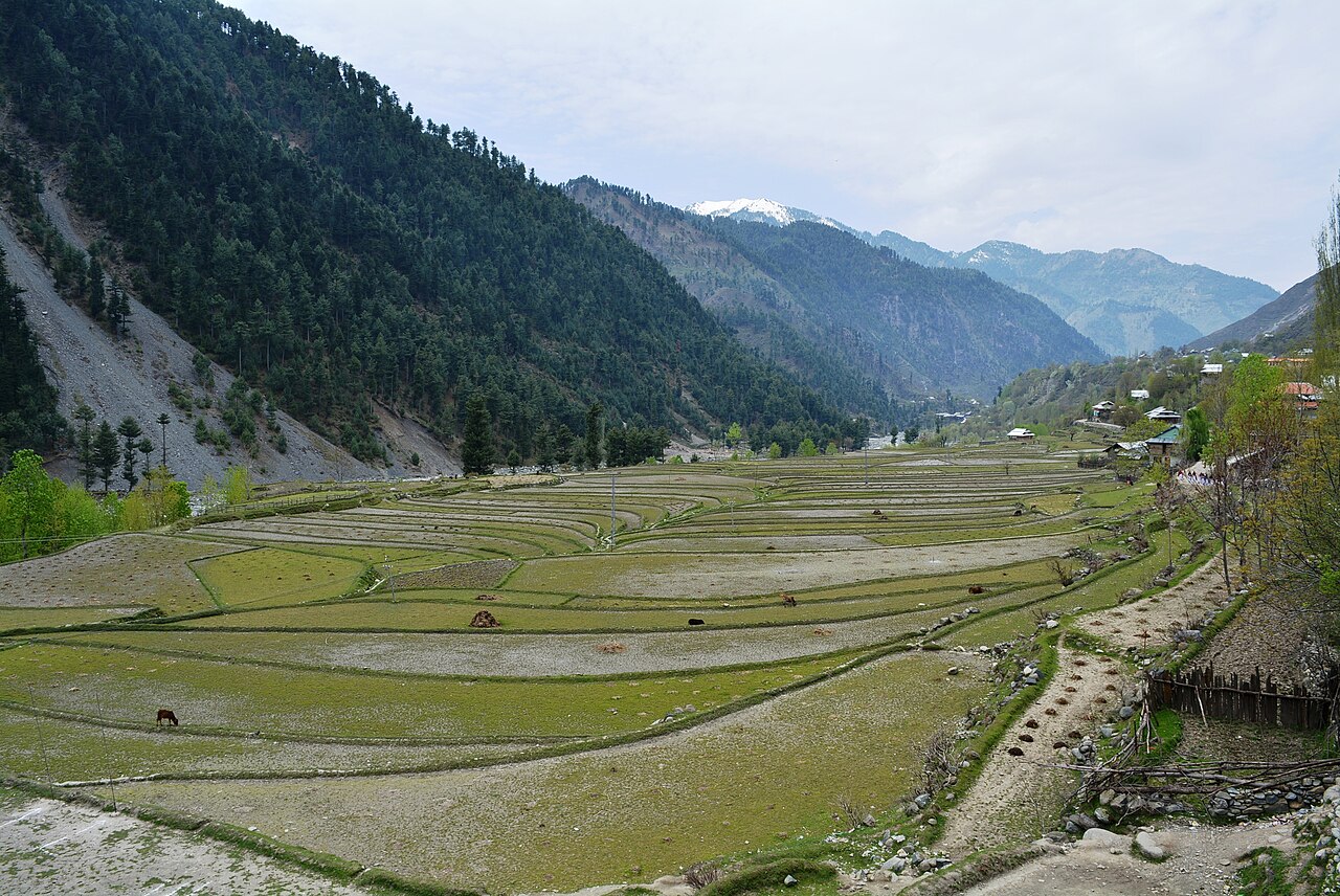
Leepa is a farmed valley about 83 kilometres from Muzaffarabad, close enough to the Line of Control that it has spent decades as contested ground. It is terraced, green and small, and the road in is the whole experience.
Weather at Leepa
Up at 2,093 m: 12°C there now, clear. Over the next 24 hours 2.1°C to 13.4°C.
This is the weather at Leepa, not a road report — whether the road is open depends on ploughing, landslides and local decisions no forecast knows about, so check before you set off. Forecast from MET Norway, CC BY 4.0.
What it costs to drive there
| From | Distance | Driving | Petrol |
|---|---|---|---|
| Islamabad | 215 km | 3.3 h | Rs 5,900 |
| Rawalpindi | 229 km | 3.5 h | Rs 6,300 |
| Lahore | 582 km | 7.5 h | Rs 15,900 |
| Karachi | 1633 km | 19.8 h | Rs 44,600 |
| Peshawar | 364 km | 5.1 h | Rs 9,900 |
| Multan | 755 km | 9.8 h | Rs 20,600 |
A car doing 12 km/l at today’s Rs 328.00/litre. Open a row to work it out for your own car, your own speed and with the air conditioning on — or see every distance from Leepa.
What it is
An arable valley in Hattian Bala District, split into five sectors — Nowkot, Kasirkot, Dao Khan, Leepa and Chananian — of small hamlets and rice terraces.
It was formerly part of Karnah tehsil in Kupwara district of Jammu and Kashmir, and it has been an area of strife between the two countries since.
The road
From Muzaffarabad it is about 83 kilometres by the record's measure, over a pass, and it is the kind of road people make videos about specifically to answer the question of whether an ordinary car can do it.
Access is sometimes restricted for reasons that have nothing to do with the weather. Check before setting off.

What it looks like
Rice terraces stacked up the valley sides, wooden houses, and maize and walnut. It looks more like Kashmir proper than like the Galyat or Kaghan, because it is.
What there is to see
- The rice terraces
- The thing people come to photograph, and at their best late in the season.
- Reshian pass
- The way in, and the climb that defines the drive.
- The hamlets
- Nowkot, Kasirkot, Dao Khan, Leepa and Chananian, strung along the valley floor.
When to go, and when not to
May to October. The pass closes in winter.
This is a Line of Control valley. Access can be restricted at short notice, and that is not something a forecast or this page can tell you — check locally.
Where this comes from
- Leepa Valley — Wikipedia — The distance from Muzaffarabad, the five sectors and the history. Written from it, not copied; Wikipedia is CC BY-SA 4.0.
- MET Norway — The live forecast and the place's height, CC BY 4.0.
- OpenStreetMap — Road distances and driving times, via OSRM.