
Naltar
Gilgit District, Gilgit-Baltistan
On video
Exploring Naltar Valley and its Lakes by Khurram Travel Maverik on YouTube. Not ours, and not an endorsement — it is the clearest look at the drive and the valley we could find.
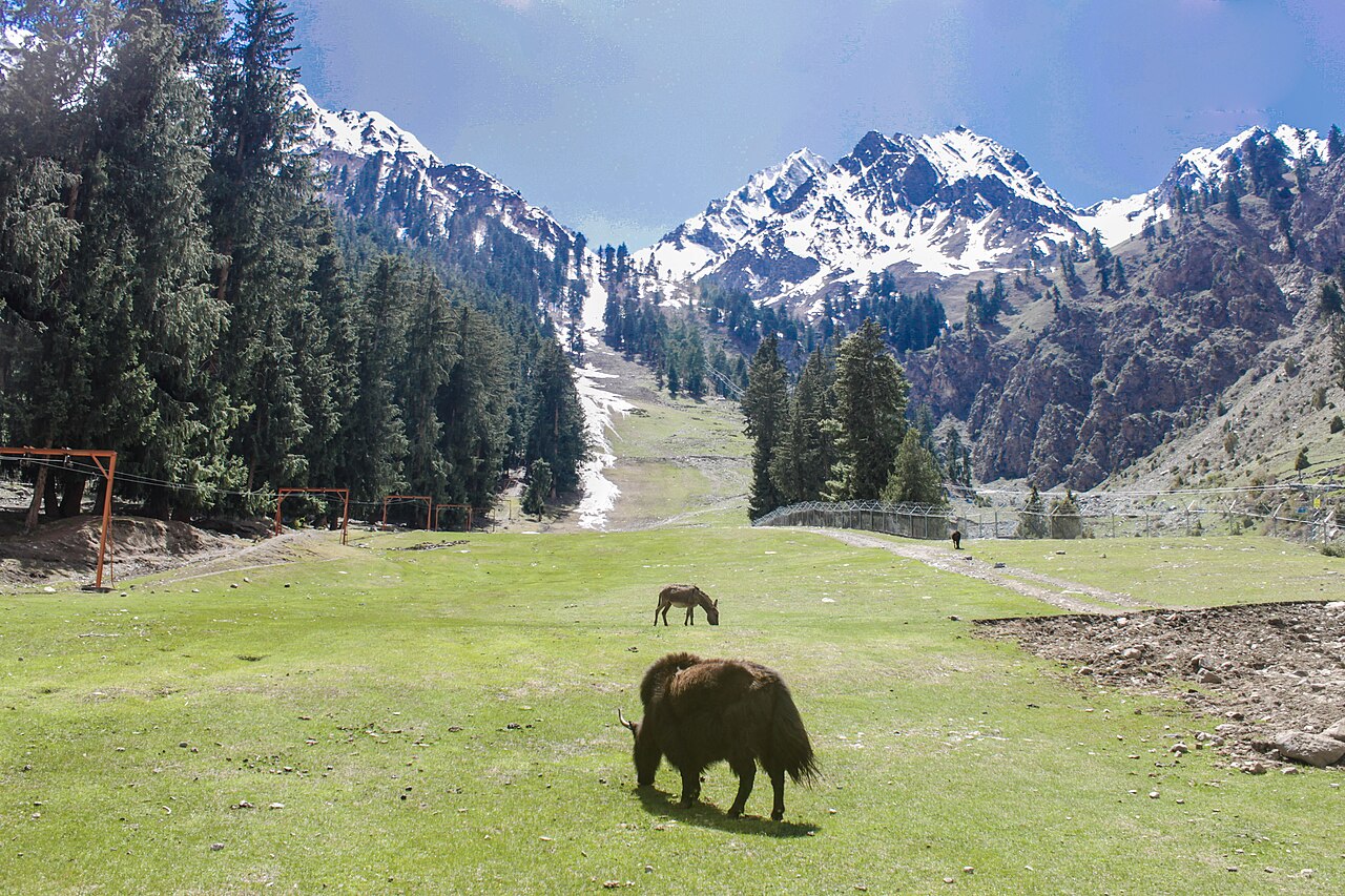
Naltar is a forested valley about 34 kilometres from Gilgit with three alpine lakes at the top of it, and it is where Pakistan's ski team trains. The road in is the reason most people never get there.
Weather at Naltar
Up at 2,968 m: -2.2°C there now, clear. Over the next 24 hours -12.6°C to 0.6°C. It goes below freezing.
This is the weather at Naltar, not a road report — whether the road is open depends on ploughing, landslides and local decisions no forecast knows about, so check before you set off. Forecast from MET Norway, CC BY 4.0.
What it costs to drive there
| From | Distance | Driving | Petrol |
|---|---|---|---|
| Islamabad | 516 km | 7.6 h | Rs 14,100 |
| Rawalpindi | 525 km | 7.7 h | Rs 14,400 |
| Lahore | 877 km | 11.5 h | Rs 24,000 |
| Karachi | 1909 km | 25.4 h | Rs 52,200 |
| Peshawar | 611 km | 8.5 h | Rs 16,700 |
| Multan | 1045 km | 13.8 h | Rs 28,600 |
A car doing 12 km/l at today’s Rs 328.00/litre. Open a row to work it out for your own car, your own speed and with the air conditioning on — or see every distance from Naltar.
What it is
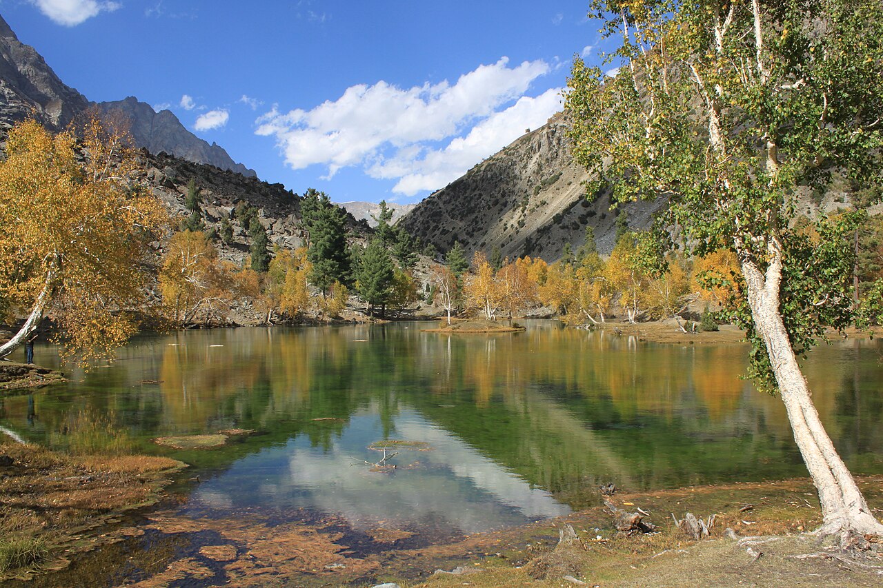
A valley north-west of Gilgit with two settlements — Naltar Bala, the upper, about 34 kilometres from the city, and Naltar Paain, the lower, about 40. It is distinguished by forest, which is unusual in this part of Gilgit-Baltistan, and by three lakes: Strangi, Blue and Bodlok.
The Naltar Expressway connects it to Gilgit via Nomal and Faizabad, and a road from Nomal runs on through to China.

The drive
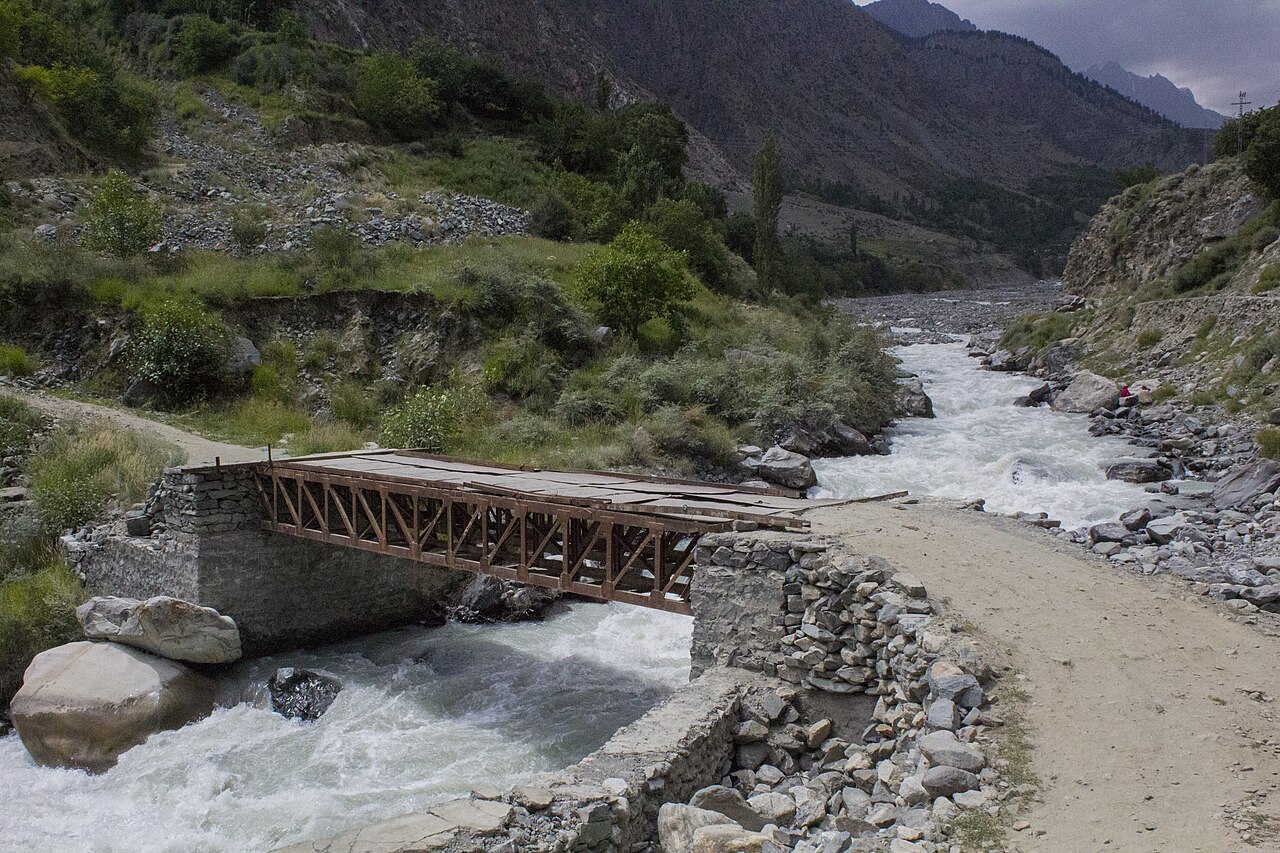
Forty-five kilometres from Gilgit and well over an hour of it, which tells you what the surface is like. The last stretch is a jeep track with some narrow bridges.
This is a valley people reach in a hired jeep from Gilgit rather than in their own car, and that is worth deciding before setting off rather than at the bridge.
The ski slope
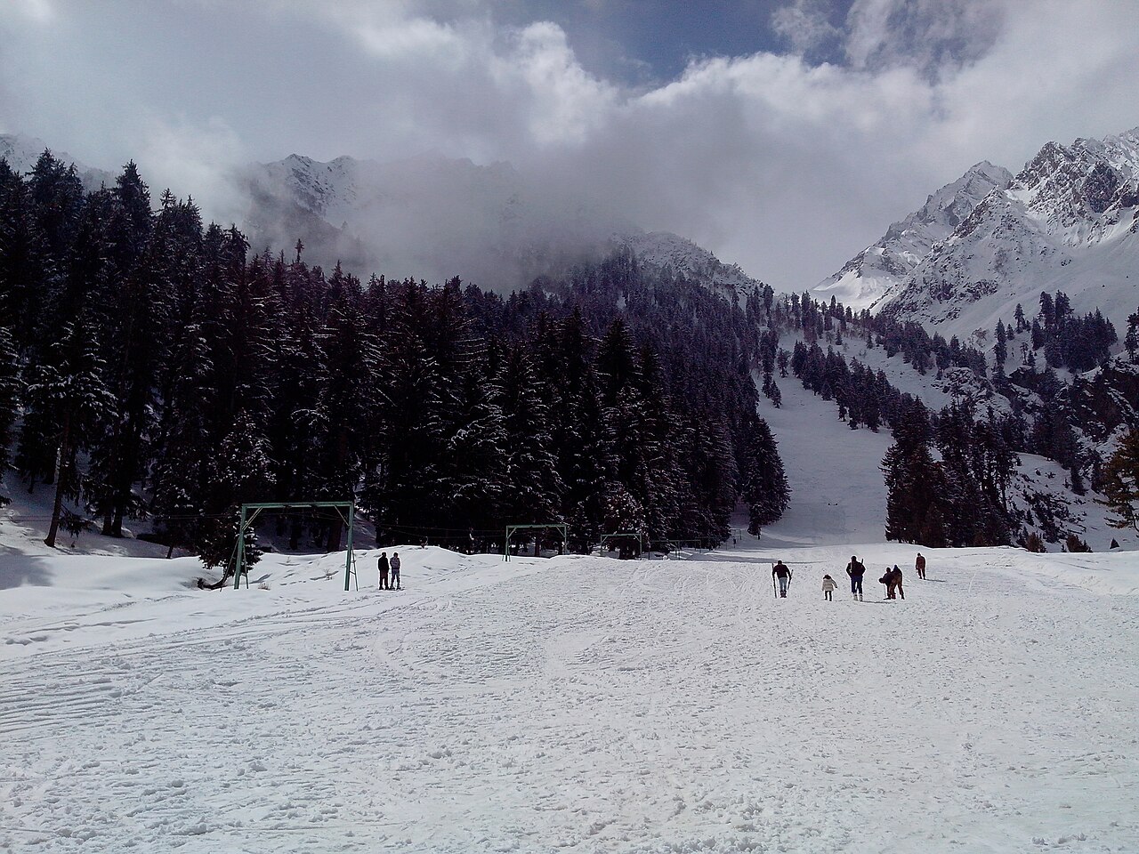
The Pakistan Air Force runs a ski resort here, and national competitions are held on it. At around 3,000 metres with reliable winter snow it is the closest thing the country has to a working ski area outside Malam Jabba.
What there is to see
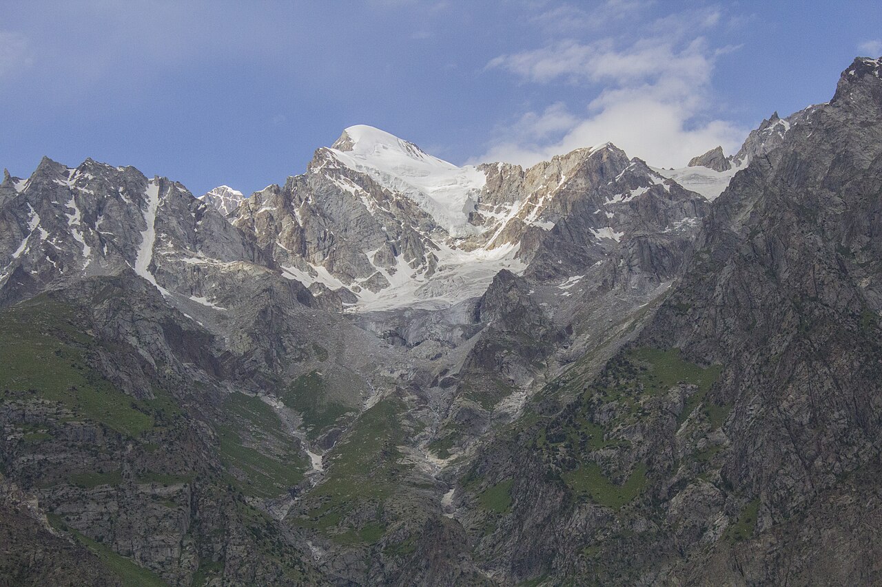
- Blue Lake
- The best known of the three, up beyond Naltar Bala.
- Strangi and Bodlok
- The other two, further on and quieter.
- The ski slope
- Air Force-run, and in use for national competitions in winter.
- The forest
- Rare at this latitude and altitude in Gilgit-Baltistan, and the reason the valley looks different from everything around it.
When to go, and when not to
May to October for the lakes. January and February for snow, if the skiing is the point.
The track is the limiting factor in either season, not the weather at Gilgit.
Where this comes from
- Naltar Valley — Wikipedia — The three lakes, the two settlements and their distances from Gilgit, and the road. Written from it, not copied; Wikipedia is CC BY-SA 4.0.
- MET Norway — The live forecast and the place's height, CC BY 4.0.
- OpenStreetMap — Road distances and driving times, via OSRM.