
Ranikot Fort
Jamshoro District, Sindh
On video
Ranikot Fort Drone View — Jamshoro by Expedition Pakistan on YouTube. Not ours, and not an endorsement — it is the clearest look at the drive and the valley we could find.
Ranikot has about thirty kilometres of wall running over the Kirthar hills, which is why it gets called the Great Wall of Sindh. Nobody knows who built it or why. Inscriptions found in 2018 point to the Gupta period — the fourth or fifth century AD.
How far you can drive: The distances below are to Hyderabad. Ranikot is 90 kilometres north on the Indus Highway (N55); a diversion a little past Sann, the nearest town, then runs 21 kilometres of rough road to the eastern gate. That last 21 km is the part to think about before setting off in a low car.
What it costs to drive to Hyderabad
| From | Distance | Driving | Petrol |
|---|---|---|---|
| Islamabad | 1262 km | 14.7 h | Rs 34,500 |
| Rawalpindi | 1251 km | 14.8 h | Rs 34,200 |
| Lahore | 1057 km | 12 h | Rs 28,900 |
| Karachi | 160 km | 1.9 h | Rs 4,400 |
| Peshawar | 1396 km | 16.2 h | Rs 38,200 |
| Multan | 736 km | 8.6 h | Rs 20,100 |
A car doing 12 km/l at today’s Rs 328.00/litre. Open a row to work it out for your own car, your own speed and with the air conditioning on — or see every distance from Hyderabad.
What it is
A fort near Sann in Jamshoro District, inside Kirthar National Park — the second largest national park in Pakistan. Its ramparts get compared to the Great Wall of China, which is a stretch, but the scale is genuinely hard to take in from the ground.
Pakistan nominated it for World Heritage status in 1993 and it has been on UNESCO's tentative list since. It is a protected historical site under the Antiquities Act of 1975.

Nobody knows who built it
The original purpose and the architects are unknown. It used to be attributed to the Sassanians, the Scythians, the Parthians or the Bactrian Greeks — a list long enough to tell you how little was settled.
In March 2018 three inscriptions were found on the south-eastern corner. One of them, nine symbols engraved on a cliff, was sent to Dr Nasim Khan at Peshawar University, who dated it to the Gupta period — the fourth or fifth century AD.
Badar Abro, who spent years doing fieldwork here, found prehistoric caves, iron arrowheads he believes are Scythian, and coins from several periods including the Habbarid era of Sindh and the later Mughals. Archaeologists have pointed to the seventeenth century as the date of first construction, but Sindh archaeologists now accept that some of the present structure is older.
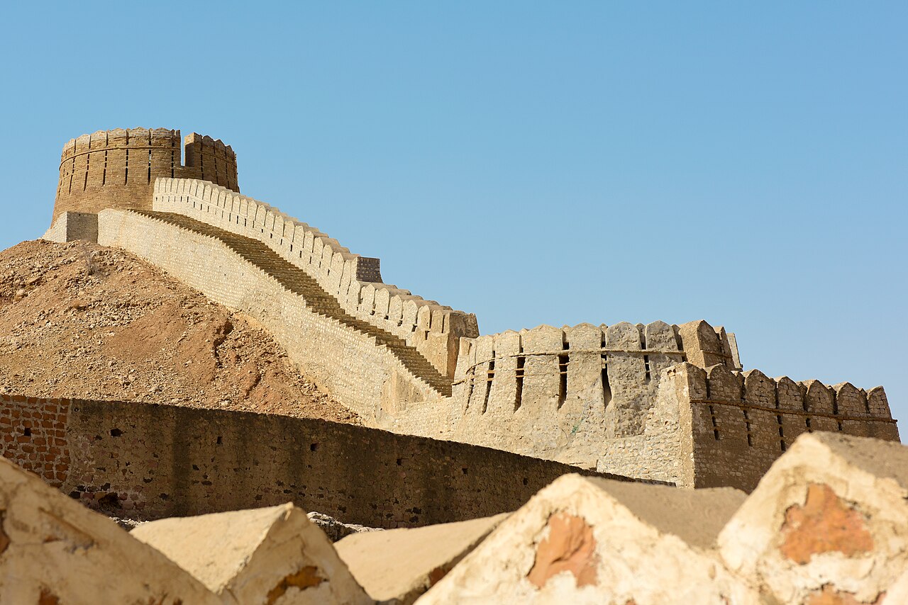
Getting there
It is 90 kilometres north of Hyderabad on the Indus Highway, and roughly an hour from Karachi as far as Sann. Sann is the nearest town and a railhead on the Kotri–Larkana line.
The diversion to the fort leaves the highway a little past Sann and covers 21 rugged kilometres to the Sann Gate. That is the stretch that decides what you should be driving.

What there is to see
- The wall
- About thirty kilometres of it, following the ridge line. The reason to come.
- Sann Gate
- The eastern gate, where the diversion road reaches the fort.
- Kirthar National Park
- The fort is inside it — the second largest national park in the country.
- Sann
- The nearest town, on the Indus Highway and on the railway.

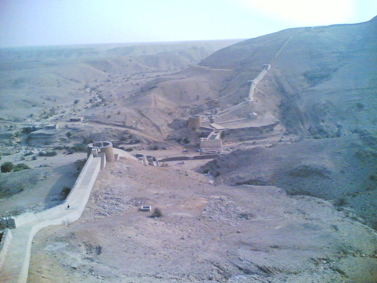
When to go, and when not to
November to February. The Kirthar hills are bare rock and scrub with no shade anywhere, and in summer this is one of the hotter places in the country.
Go early and carry water. There is nothing at the fort — no shop, no shade — and the 21 kilometres back to the highway are not somewhere to break down in the afternoon.
Where this comes from
- Ranikot Fort — Wikipedia — The Gupta-era dating and the 2018 inscriptions, Dr Nasim Khan's reading, Badar Abro's finds, the 1993 UNESCO nomination and tentative listing, the 90 kilometres from Hyderabad and the 21-kilometre diversion past Sann, and Kirthar National Park. Written from it, not copied; Wikipedia is CC BY-SA 4.0.
- OpenStreetMap — Road distances and driving times, via OSRM.