
Rohtas Fort
Jhelum District, Punjab
On video
Inside Pakistan's Most Incredible Military Fort — Rohtas Fort by Karl Rock on YouTube. Not ours, and not an endorsement — it is the clearest look at the drive and the valley we could find.
Rohtas Fort is a sixteenth-century fortress near Dina in Jhelum, built by Sher Shah Suri to keep Humayun out of India and the Gakhars down. It is a UNESCO World Heritage Site, it is remarkably intact, and a village has been living inside its walls continuously since the 1500s.
What it costs to drive there
| From | Distance | Driving | Petrol |
|---|---|---|---|
| Islamabad | 110 km | 1.5 h | Rs 3,000 |
| Rawalpindi | 102 km | 1.5 h | Rs 2,800 |
| Lahore | 194 km | 2.7 h | Rs 5,300 |
| Karachi | 1351 km | 16.2 h | Rs 36,600 |
| Peshawar | 279 km | 3.5 h | Rs 7,600 |
| Multan | 469 km | 6.2 h | Rs 12,700 |
A car doing 12 km/l at today’s Rs 325.00/litre. Open a row to work it out for your own car, your own speed and with the air conditioning on — or see every distance from Rohtas Fort.
What it is
A fortress near the city of Dina in Jhelum District, commissioned by the Sur emperor Sher Shah Suri and built under the supervision of Raja Todar Mal. It is one of the largest and most formidable forts in Punjab.
UNESCO declared it a World Heritage Site in 1997 and called it an exceptional example of the Muslim military architecture of Central and South Asia. More than a third of the enclosed area is taken up by Rohtas village, lived in without a break since the time of Islam Shah Suri — which makes this one of the few living forts in the world.

Where it stands, and why there
The fort is about 16 kilometres north-west of Jhelum, three kilometres from Khukha and Gaggar Khurd, and eight kilometres south of the Grand Trunk Road — one of the oldest roads in Asia. The historic Badshahi Road ran along its northern outer wall.
It sits on a hill in the Tilla Jogian range above a gorge where the Kahan river meets a seasonal stream, 91.5 metres above the ground around it, 819 metres above sea level, covering 70 hectares. The position closes the gap between the Pothohar mountains and the plains of Punjab.
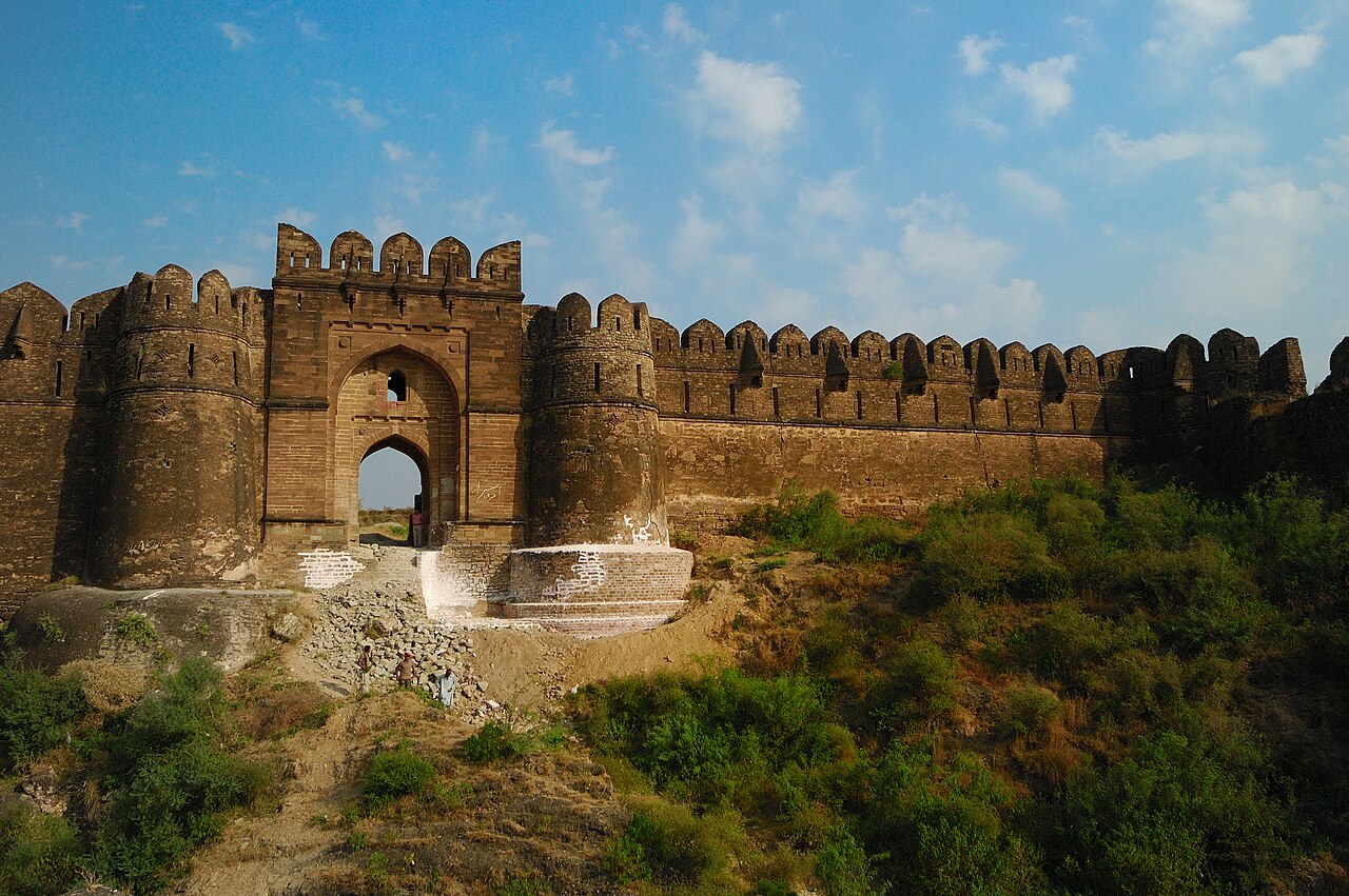
Sher Shah, Todar Mal and the Gakhars
Sher Shah Suri commissioned the fort on the advice of his finance minister Todar Mal, as part of a scorched-earth campaign against the Gakhars, a local tribe resisting the Surs near the Salt Range. The point was strategic: a fort here would stop Humayun returning from exile in Persia.
Construction began in 1541 under Todar Mal, himself a Punjabi from Lahore, and stalled almost immediately because the local Gakhar population would not work on it. The name celebrates Sher Shah's capture in 1539 of a different Rohtas, in the Shahabad district of Bihar.

What there is to see
- Sohail Gate
- The best-preserved of the gates and the usual way in.
- Kabuli Gate
- The northern gate, facing the old Badshahi Road.
- Rani Mahal
- Inside the walls, the small palace in the enclosure.
- Shahi Masjid
- The mosque in the fort, by the Kabuli gate.
- Rohtas village
- The living part — a third of the fort's area, inhabited since the 1500s.
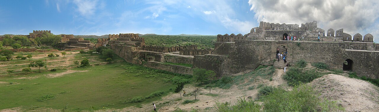


When to go, and when not to
October to March. There is a lot of walking on exposed stone here and very little shade, and a Punjab summer afternoon on top of a curtain wall is not an experience worth having.
It is close enough to the Grand Trunk Road and the motorway to pair with Khewra or Katas Raj in a day, which is the usual way it is done.
Where this comes from
- Rohtas Fort — Wikipedia — Sher Shah Suri and Todar Mal, the 1997 UNESCO listing and its wording, the living village, the distances to Jhelum, Dina and the Grand Trunk Road, the 91.5-metre elevation above the surroundings, 819 metres above sea level and 70 hectares, the Gakhar campaign and the 1541 start, and the Bihar namesake. Written from it, not copied; Wikipedia is CC BY-SA 4.0.
- OpenStreetMap — Road distances and driving times, via OSRM.