
Shigar
Shigar District, Gilgit-Baltistan
On video
The Road from Skardu to Shigar Valley by DishTvPhotoExpress on YouTube. Not ours, and not an endorsement — it is the clearest look at the drive and the valley we could find.
Shigar is the town at the mouth of the valley that leads to the Baltoro — the way to K2, Broad Peak and the Gasherbrums. It has a seventeenth-century fort, restored and now a hotel, and a river that comes down from five of the world's fourteen eight-thousanders.
How far you can drive: The distances below are to Skardu. Shigar town is 27 kilometres further on metalled road, about half an hour. What is not half an hour is what lies beyond it: the valley runs on roughly 170 kilometres to Askole, the end of the road and the start of the walk to K2, and that stretch is jeep track and suspension bridges.
Weather at Skardu
Up at 2,319 m: -1.8°C there now, clear. Over the next 24 hours -4.9°C to 4.6°C. It goes below freezing.
This is the weather at Skardu, not a road report — whether the road is open depends on ploughing, landslides and local decisions no forecast knows about, so check before you set off. Forecast from MET Norway, CC BY 4.0.
What it costs to drive to Skardu
| From | Distance | Driving | Petrol |
|---|---|---|---|
| Islamabad | 743 km | 9.3 h | Rs 20,300 |
| Rawalpindi | 739 km | 9.4 h | Rs 20,200 |
| Lahore | 1089 km | 13 h | Rs 29,800 |
| Karachi | 2140 km | 25.4 h | Rs 58,500 |
| Peshawar | 758 km | 9.8 h | Rs 20,700 |
| Multan | 1258 km | 15.4 h | Rs 34,400 |
A car doing 12 km/l at today’s Rs 328.00/litre. Open a row to work it out for your own car, your own speed and with the air conditioning on — or see every distance from Skardu.
Distances into Gilgit-Baltistan are the year-round Karakoram Highway route. The shortcut over Babusar Top is roughly a hundred kilometres less, and is open from about mid-July to late September.
What it is
The headquarters of Shigar District and tehsil, in the Baltistan division, on the bank of the Shigar river. It is the gateway to the Karakoram, which holds five eight-thousanders including K2.
The town is inhabited almost entirely by Balti people of Tibetan descent. About 65 per cent are Shia, 26 per cent Noorbakhshi and the rest Sunni.
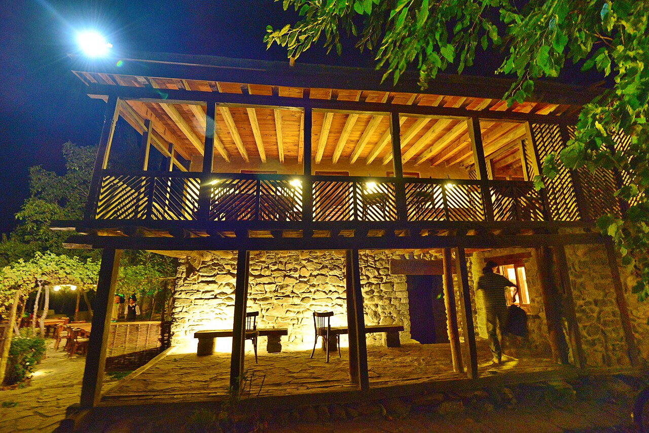
The Amachas
The ruling dynasty before the Dogra conquest were the Amachas, who traced their descent from the Ayash dynasty of Hunza and used the same title, Tham. The main source for them is the Shigarnamah, written in 1752. Ahmad Hasan Dani derived Amacha from the Sanskrit amatya, minister; the founder was Cha Tham, a Hunza prince.
Syed Ali Hamdani is said to have arrived in the late fourteenth century and converted the population; mosques and khanqahs attributed to him still stand. Mir Shams-ud-Din Araqi came during the reign of Ghazitham II. Shigar was invaded in 1532 by Sultan Said Khan of Yarkent, conquered in 1634 by Abdal Khan of Skardu, and recovered by the Amachas with Mughal help. The last ruler was Haidar Khan, during whose reign Zorawar Singh conquered Baltistan in 1842.
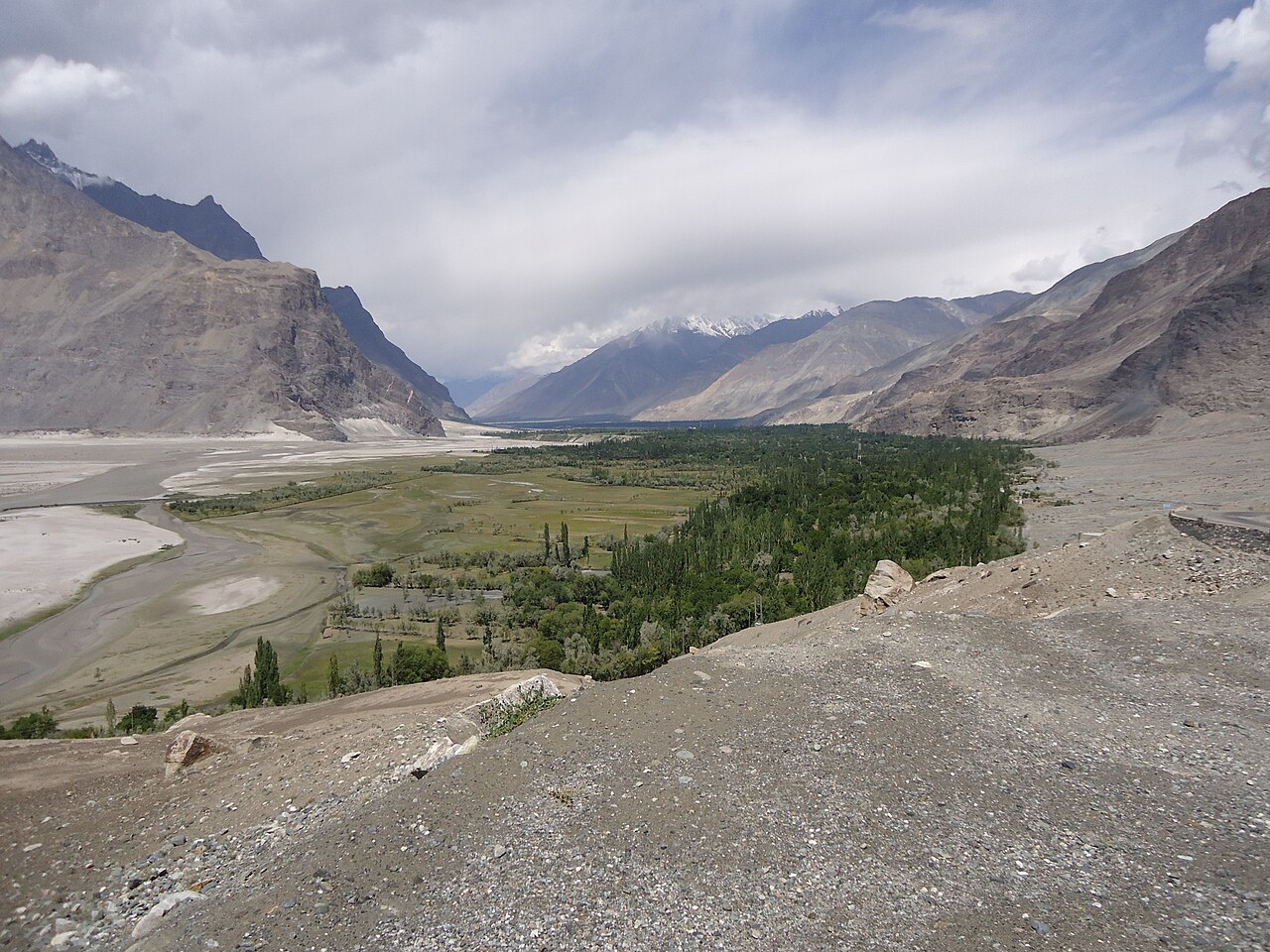
The valley, and what it leads to
Shigar Fort was built in the seventeenth century by the Raja of the Amacha dynasty. It was restored and now runs as a hotel, which is why it is in better condition than most buildings of its age in the region.
The valley above the town is farmed — apricot, apple and barley on the flat ground — and then stops being farmed. From Shigar it is roughly 170 kilometres to Askole, which is where the road ends and the trek to Concordia and K2 Base Camp begins.

What there is to see
- Shigar Fort
- Seventeenth century, restored, now a hotel. Worth walking into either way.
- The valley floor
- Apricot and barley on the flat, with the Karakoram standing over it.
- The road to Askole
- About 170 km of jeep track and old suspension bridges, ending where the K2 trek starts.
- The Shigar river
- Meltwater off the Baltoro, through the middle of all of it.
- Skardu
- 27 km back, and as far as the distances here are measured.
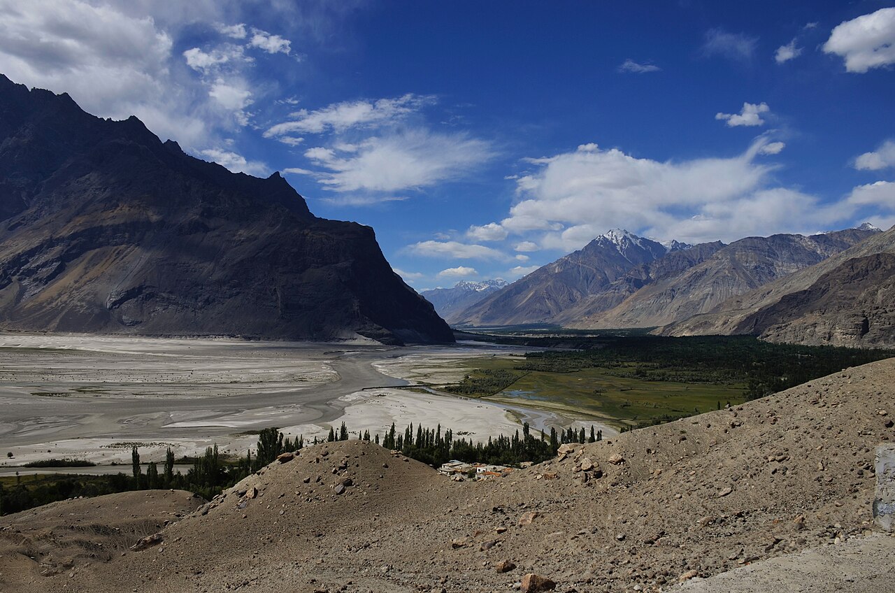

When to go, and when not to
April to October. Late April and May for blossom on the valley floor; June to September if the point is to go on towards Askole, which is the only window in which that makes sense.
Winter shuts the upper valley and makes the track to Askole irrelevant. Shigar town itself stays reachable from Skardu for most of the year.
Where this comes from
- Shigar — Wikipedia — The district headquarters and the Shigar river, the gateway to the Karakoram and its five eight-thousanders, the Balti population and the sect proportions, the Amacha dynasty and the Shigarnamah, Dani's etymology, Ali Hamdani, the 1532 and 1634 invasions and the 1842 Dogra conquest. Written from it, not copied; Wikipedia is CC BY-SA 4.0.
- MET Norway — The live forecast and the town's height, CC BY 4.0.
- OpenStreetMap — Road distances and driving times, via OSRM, including the Skardu–Shigar figure.