
Siri Paye
Kaghan Valley, Mansehra District, Khyber Pakhtunkhwa
On video
Siri Paye Shogran - Heaven In Naran Kaghan Valley by Sadia Rafay on YouTube. Not ours, and not an endorsement — it is the clearest look at the drive and the valley we could find.
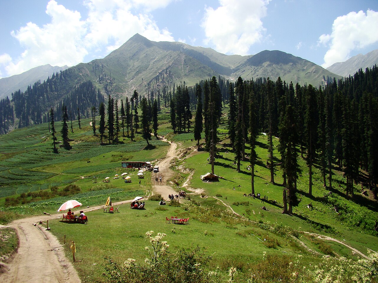
Siri Paye is not one place but two meadows above Shogran, each with a small lake in it, at the top of a jeep track that defeats most cars. It is the easiest high meadow in the Kaghan valley to reach and the one people mean when they say they have "been up from Shogran".
How far you can drive: The distances below are to Shogran, at 2,362 metres, which is as far as an ordinary car goes. Siri and Payee are above it on a jeep track — Siri Lake at about 2,590 metres, Payee at about 2,895 metres — and that last stretch is why there are hired jeeps parked in Shogran all summer.
Weather at Shogran
Up at 2,338 m: 12.1°C there now, clear. Over the next 24 hours -0.9°C to 13.5°C. It goes below freezing.
This is the weather at Shogran, not a road report — whether the road is open depends on ploughing, landslides and local decisions no forecast knows about, so check before you set off. Forecast from MET Norway, CC BY 4.0.
What it costs to drive to Shogran
| From | Distance | Driving | Petrol |
|---|---|---|---|
| Islamabad | 189 km | 2.7 h | Rs 5,200 |
| Rawalpindi | 199 km | 2.8 h | Rs 5,400 |
| Lahore | 549 km | 6.5 h | Rs 15,000 |
| Karachi | 1581 km | 20.4 h | Rs 43,200 |
| Peshawar | 283 km | 3.5 h | Rs 7,700 |
| Multan | 718 km | 8.8 h | Rs 19,600 |
A car doing 12 km/l at today’s Rs 328.00/litre. Open a row to work it out for your own car, your own speed and with the air conditioning on — or see every distance from Shogran.
What it is
Two meadows on the shoulder above Shogran, named after the lakes in them. Siri Lake sits at about 2,590 metres on the way up; Payee Lake is in the middle of the higher meadow at about 2,895 metres. The track reaches Siri first and ends at Payee.
What people photograph is Payee: a shallow pool in open grass with Makra Peak standing over it. Malika Parbat, Musa ka Musala and the Kashmir mountains are all visible from the same meadow on a clear day.
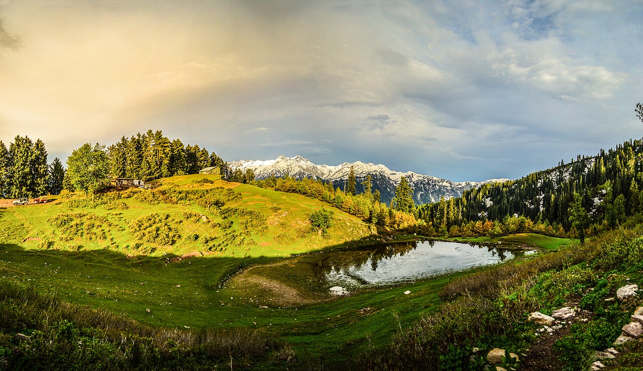
The track, and what you are driving
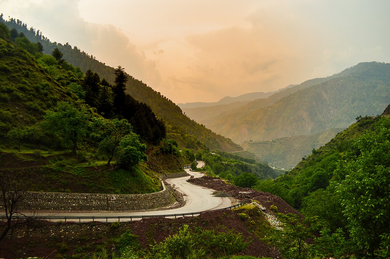
The access runs from Kewai on the Kaghan valley road: a single seven-kilometre road climbs to Shogran, and the track then continues past Siri and ends at Payee. The road to Shogran itself is metalled and an ordinary car manages it.
Above Shogran it is a jeep track, and that is the whole reason this page separates the two. A saloon should stop in Shogran. Jeeps are hired in the village in season, which is the normal way up and worth budgeting for rather than discovering at the turning.
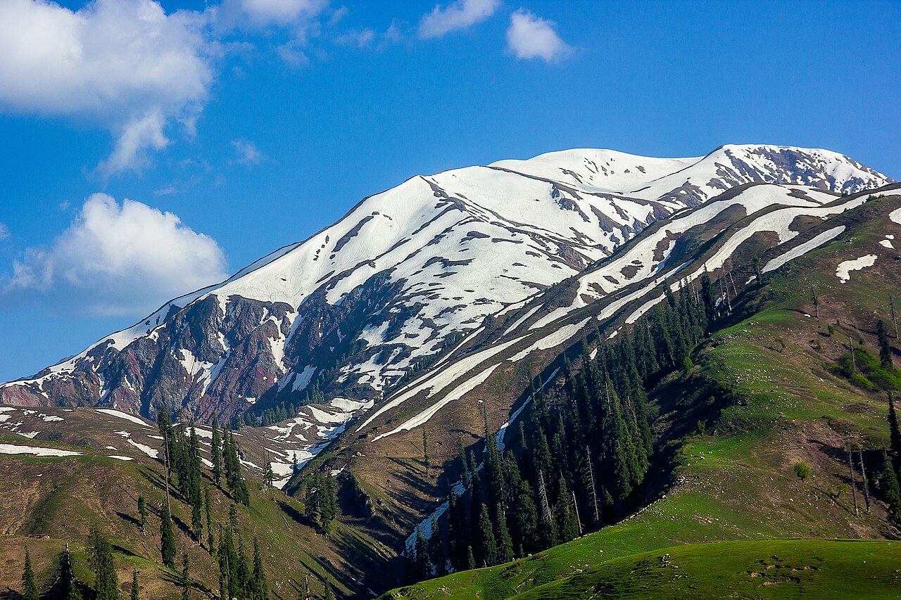
Makra, from the end of the track
Makra Peak — "spider peak" — is 3,885 metres and sits on the boundary between the Kaghan valley and Azad Kashmir. From Payee it is about a four-hour walk to the top.
It is usually described as a straightforward climb, and people have still died on it: the danger is thick fog and the steeper sections rather than technical difficulty. The glacier on it feeds the Kunhar, the river running down the whole Kaghan valley.

What there is to see
- Payee Lake
- The higher meadow and its lake, about 2,895 metres, where the track ends.
- Siri Lake
- About 2,590 metres, passed on the way up from Shogran.
- Makra Peak
- 3,885 metres, roughly four hours on foot from Payee. Fog is the hazard, not the gradient.
- Shogran
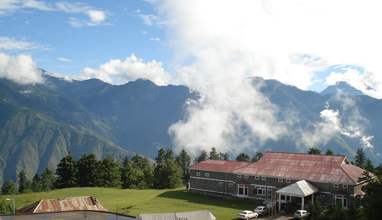
- The hill station below, at 2,362 metres — where the metalled road and most cars stop.
- Kewai
- On the Kaghan valley road, where the seven-kilometre climb to Shogran begins.
When to go, and when not to
June to August is the season for the hillside below, with temperatures between about 3°C and 20°C. The monsoon brings heavy rain and occasional hail through it, and thunderstorms here arrive without much warning.
The road to Shogran is blocked by landslides often enough to plan around — usually after rain, or in early summer when the snow starts melting. Through the winter the whole valley is under snow and the meadows are not reachable at all.
Where this comes from
- Payee Lake — Wikipedia — The height of the upper meadow and the peaks around it. Written from it, not copied; Wikipedia is CC BY-SA 4.0.
- Siri Lake — Wikipedia — The lower lake's height and the jeep track through Shogran.
- Makra Peak — Wikipedia — The 3,885-metre height, the road from Kewai, the four-hour walk from Payee, and the fog.
- Shogran — Wikipedia — The 2,362-metre height, the season, the temperature range and the landslides.
- MET Norway — The live forecast and the town's height, CC BY 4.0.
- OpenStreetMap — Road distances and driving times, via OSRM.